
Over the last 2.6 million years, the Ice Age glaciers carved and moulded many of the landforms we see today. These glaciers and their meltwater rivers eroded the underlying rocks and laid down deposits of ground-up rock, stones and gravel. They were also responsible for changes in the relative levels of the land and sea and for alterations to river courses. Beyond the ice, constant freezing and thawing created many fascinating ‘periglacial’ landforms.
Once the ice finally melted, the debris left by the glaciers provided the source materials for Scotland’s beaches and the parent materials for our soils. Unstable slopes collapsed in sometimes massive landslides. Vegetation and animals colonised the land. Coastlines rose or sank, and rivers cut their present day courses.
Historically, Scotland’s landforms played a key part in the development of the Ice Age theory in the mid-19th century. In particular, they helped convince the Swiss geologist, Louis Agassiz, of the reality of the former existence of glaciers in an area far from high mountains such as the Alps and hence represented compelling evidence for a great Ice Age. Agassiz was especially influenced by the evidence he found in the West Highlands and notably in the Glen Roy area.
Contents
The Ice Age
The current Ice Age began around 2.6 million years ago, although the climate had been gradually cooling for almost 50 million years before then. The intensification of the cooling and the onset of the Ice Age mark the start of the present geological period, the Quaternary.
Blowing hot and cold
During the Ice Age, the climate has swung regularly back and forth between warm and cold conditions. In the colder episodes (glacials), glaciers existed in Scotland; during the warmer periods (interglacials), the climate was more like it is today and may even have been warmer.
It’s still the Ice Age!
During the more intense glacials, ice sheets covered all of Scotland apart from the very highest summits. This probably occurred five or six times during the last 750,000 years, and during the many less cold episodes, smaller mountain glaciers existed in the corries and glens of the Highlands.
Today we are still in the Ice Age, albeit in a warmer, interglacial phase.
What we see today
Each successive glaciation not only helped to shape the landscape, but also removed most of the deposits of earlier glaciations. Therefore much of the evidence we see today dates from the time of the last major glacial period (the ‘Late Devensian’).
This last period began around 33,000 years ago and peaked about 22,000 year ago, when a large ice sheet covered all of Scotland and extended southwards to the Midlands of England.
Warming up
Around 15,000 years ago, the climate warmed rapidly, producing dramatic landscape changes as the glaciers melted, moraines were deposited, vast volumes of meltwater poured across the landscape and unstable slopes collapsed.
The climate warming was short-lived, however, and intensely cold conditions returned briefly after about 12,900 years ago when an ice cap developed in western Scotland, extending from Torridon to Loch Lomond, and small corrie glaciers formed in the high mountains.
This re-advance of the glaciers is known as the ‘Loch Lomond Readvance’ because evidence for it was first described from the Loch Lomond area.
Finally, around 11,500 years ago, rapid climate warming initiated the present Holocene interglacial.
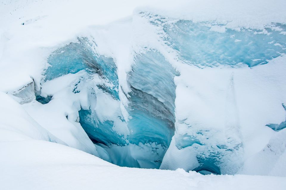
Ice-carved landscapes

Under the right conditions, glaciers can be very effective agents of erosion. In the uplands, powerful ice streams carved deep glacial troughs from the existing valleys (e.g. Glen Clova and Glen Docherty) and sometimes formed deep rock basins on their floors (e.g. Loch Ness and Loch Monar). Elsewhere, they breached watersheds, cutting new glens that now form important transport routes (e.g. Glencoe and Glen Shiel).
Scouring the landscape
In some areas, the effects of the glaciers were ‘selective’, where pre-existing glens were deepened but adjacent plateau surfaces were little altered, as in the Cairngorms. In others, the glaciers extensively scraped, scoured and roughened the bedrock, often up to the summits, forming landscapes of ‘areal scouring’, as in the Western Isles, Sutherland and Ardgour.
Eastern lowlands
In the lowlands of eastern Scotland, the landscape was moulded and streamlined by the glaciers, producing crag-and -tail landforms such as Edinburgh Castle Rock and the Royal Mile. Individual rock outcrops were often shaped into ‘roches moutonnées’, with smoothed upstream sides and quarried downstream sides; good examples occur in upper Deeside, south of Aviemore and at Dulnain Bridge.
West and Northwest Highlands
By far the greatest impact was in the West and Northwest Highlands, illustrated by the fact that 90% of the corries and more than 90% of the rock basins are in westerly flowing river catchments. There, snowfall was greater, the ice thicker and the glaciers steeper and faster flowing and hence capable of more effective erosion.
Unchanged in the northeast
In contrast, the glaciers had a relatively benign effect on the landscape in some areas, especially in Northeast Scotland. Many of the features of the pre-glacial period, especially gently rolling slopes and weathered bedrock, remain little modified (as in Buchan), tors have been uncovered but not destroyed (as on Bennachie) and river systems remain largely intact.
Ice-transported debris

Rocks and rock debris of all shapes and sizes (including tiny particles known as ‘rock flour’) are transported on the surface and at the base of glaciers. Glaciers can carry rocks long distances before depositing them. The rocky evidence that was left behind means we can tell the direction the ice moved and how far it travelled. For example, chunks of granite from Rannoch Moor now lie scattered over the Drumochter Hills to the east.
An earthy legacy
In Scotland, the glaciers deposited rock debris on the ground beneath, when their speed was reduced and as valleys widened. These deposits are particularly significant because they are so widespread in the lowlands and upland valleys and provide the parent material for many of our soils, as in East Lothian and Strathmore. In places, the till was moulded and streamlined by the glaciers to form drumlins, as in the Tweed valley, around Glasgow and in the Solway lowlands.
Moraines
Where they halted, the glaciers deposited ‘moraines’. Particularly fine examples are associated with the Loch Lomond Readvance glaciers, for example around the south end of Loch Lomond, near Buchlyvie, at Callander and in many Highland glens and corries. In places, ‘hummocky’ moraine in the form of hundreds of hillocks was deposited on valley floors, most notably in Glen Torridon.
Meltwater channels and deposits
When the glaciers melted, they fed powerful meltwater rivers. These often followed the courses of the existing river systems. However, in many cases the ice meant that the water was redirected. Many of these meltwater channels are now left dry or contain streams much smaller than the valleys in which they flow. Good examples occur along the southern margins of the Pentland Hills (e.g. at Carlops), the northern flanks of the Cairngorms and around Dinnet on Deeside.
Lakes of icy meltwater
In places, the meltwater spilled into valleys dammed by the ice and formed lakes. The most spectacular example is Glen Roy, where the ice-dammed lake shorelines are still evident as the well-known ‘Parallel Roads’. The lakes drained periodically under the ice in great floods.
Distinctive landforms
The deposits from these meltwater rivers frequently form distinctive landforms composed of sand and gravel.
- Along the flanks of the glaciers, ‘kame’ terraces were deposited (e.g. between Loch Ness and Inverness).
- Under the ice (usually in tunnels), sinuous ridges or ‘eskers’ were formed (e.g. at Carstairs).
- Beyond the ice margin the debris was laid down in the form of ‘outwash’ plains or lake deltas (e.g. at Achnasheen).
The vast extent of these deposits in the glens and lowlands in the east and south of Scotland emphasises the contrasts between the landscapes predominantly of glacial erosion in the west and glacial deposition in the east.
Ice edge
Beyond the limits of the ice, constant freezing and thawing of water in the ground created many fascinating landforms which can still be seen today. These forms derive from what is technically termed ‘periglacial’ activity beyond the ice margins and can be seen being formed in arctic and alpine areas today.
On the plateaux
- On many mountain plateaux you can see hummocky ground, where seasonal freezing and thawing has caused the soil surface to bulge in a regular formation.
- There is evidence on these plateaux of the wind having blown sand and gravel, just as it does in coastal sand dunes.
- ‘Blockfields’ comprising large blocks of stone are common on many mountain tops and plateaux in Scotland. These formed as frost and ground-ice shattered the bedrock.
Steep places
On steeper slopes, the loosened boulders and soil have gradually moved downslope, forming distinctive sheets, terraces and lobes of debris and boulders. Larger boulder lobes in Scotland were last active during the Loch Lomond Readvance (12,900 – 11,500 years ago), but some smaller features have been moving during the last few thousands years.
The trimline
Often on mountain sides there is a distinct lower limit to periglacial landforms formed during the galciation; this ‘trimline’ marks the upper level of erosion associated with the advance of ice down a valley, trimming off the periglacial forms which were still active above the level of the ice.
Lower ground
On lower ground, examples of periglacial features are more difficult to see. In the gravel terraces of the river valleys, ice-wedge casts can sometimes be found where the permanently frozen ground contracted and cracked. The cracks were filled with material from the surrounding area. At a few sites you can see the rumpling up into folds of the soil layers through repeated freezing and thawing.
Active today
Although smaller than the landforms formed at the end of the last glaciation, modern active features include sorted stone stripes, sorted circles, turf-banked terraces, ‘ploughing’ boulders, wind-eroded (deflation) surfaces and wind-patterned vegetation.
After the ice
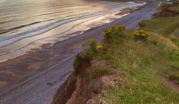
One of the most dramatic effects after the ice was the changing position of the coastline in response to changes in relative sea level.
Relative sea level has varied around Scotland, probably rising all the time in Orkney, Shetland and the Western Isles over the last 11,500 years, but elsewhere falling, then rising to a maximum 6,000-7,000 years ago, before falling again gradually to its present level.
An unstable legacy
The glaciers left behind many unstable rock slopes. Screes accumulated, blanketing steep slopes below cliffs. Where screes have buried their crags, rock falls have ceased, and vegetation taken over. Some big crags collapsed in massive rockfall events, leaving large jumbles of boulders on valley floors (e.g. the Lost Valley in Glencoe). In some cases whole hillsides moved downslope (e.g. along the Trotternish Peninsula on Skye).
In the valleys
Rivers have reworked glacial and meltwater deposits. In the river valleys, sequences of terraces formed as the rivers adjusted to fluctuating, but generally lower volumes of water and transported sediment. Abandoned channels are often visible on these terraces, and alluvial fans have been deposited from side valleys onto the terrace surfaces (e.g. in Glen Feshie).
Green and growing
After the ice melted, we know from pollen records that vegetation began to develop on the bare mineral soils from about 14,000 years ago. The speed of plant colonisation and soil development were affected by the varying nature of the surface material, and by the changing climate, being retarded during the cold interval when the Loch Lomond Readvance occurred (12,900-11,500 years ago). Crowberry, birch and willow were early colonisers, often succeeded by ash and hazel and later by oak, elm and pine. During wetter periods, peat expanded in many parts of the Highlands (especially the blanket bogs of Caithness and Sutherland), as well as the extensive lowland raised bogs in Central Scotland. At the same time, extensive heathlands were developing.
Clues to animal life
Deposits in caves in Assynt have preserved important clues about the animals that lived in Scotland during and after the ice. The bones of animals no longer found in Britain, including the brown bear, reindeer, lynx and wolf, have all been unearthed.
