
- Height: 500 ft
- Distance: 3 miles
- Difficulty: Moderate.
- Total Time: Allow about 60 – 90 minutes.
- Navigation: The paths are clear and well-walked.
- Starting Point: Just beyond the Shieldaig Lodge Hotel on the B8056 (NG805725).
- Public Transport: Post bus service from Gairloch to Redpoint.
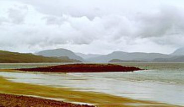
This is a walk on good paths to the Fairy Lochs and a crash site high above Shieldaig. The views back over to Gairloch are magnificent.

This walk is not in the main deer stalking area, but if you plan to walk to the Fairy Lochs between 1st of September and 21st of November, check with the Shieldaig Lodge Hotel.
Start this walk by driving south from Gairloch, taking the turning for Badachro and drive for about a mile until you reach the Shieldaig Lodge Hotel. Park just beyond the hotel on the left (NG805725).

Walk back along the road, crossing a river, until you see a good track on your right. Follow this track for about half-a-mile, until you reach a cairn and a signpost for the Fairy Lochs. The path splits here, so take the left path, which leads up past some cairns until you reach the first loch. There is a sign here for the Crash Site. Turn right to follow the side of loch, then strike out over open ground between rock formations called the “Rocky Knowles”. Below and to the left is the wreckage of the crash site with the memorial plaque and part of the propeller against a rocky wall. The crash site has an eerie feel to it, with the wreckage strewn over the ground and in the loch. This is a War Grave, so please do not remove any of the wreckage.

and the Fairy Loch and Crash Site (right).
According to the “Short Walks around Gairloch” booklet, written by Steve Chadwick (available from the Tourist Board and local bookshops), the crew of nine and six passengers took off from Prestwick on the 13th June, 1945, returning home after the war.
The B-24H left at 1315 hours from Prestwick on a route that should have taken it over Stornoway, but we can only guess at why it came over the mainland. A navigational error, instrumental or engine failure, all are possible. For whatever reason, to find themselves descending through thick cloud to attempt an emergency landing must have been fearsome.
It seems the aircraft struck the top of Slioch and lost some bomb bay door parts. The descent continued until they broke through the cloud base over Gairloch. They circled once round the loch, possibly looking for a place to ditch, and may have decided on the sea loch itself. The aircraft was on the run in when they just failed to clear the rocky spurs by the Fairy Lochs. All crew and passengers were killed.

the Crash Site back towards Gairloch.
You can either return by the outward route or you can continue left to the end of the loch below the wreckage. A series of cairns and a burn, but not a clear path, lead down to Loch Horrisdale and the main path. Turn to the right to go back to Shieldaig.
Map Required:
- OS Landranger 19: Gairloch and Ullapool Area


