- Height: 1050 ft
- Distance: 7.5 miles
- Difficulty: Moderate to Hard
- Total Time: 3 hours
- Navigation: The tracks leading to the summit are clear.
- Starting Point: War Memorial in Strathblane(NS553803).
- Public Transport: Bus to Strathblane War Memorial.
Do not attempt in the rain or mist. Stout shoes or hillwalking boots should be worn.
Care must be taken to avoid the scree slopes and cliffs on the south and east sides. There has been at least one fatality on this hill in recent years.
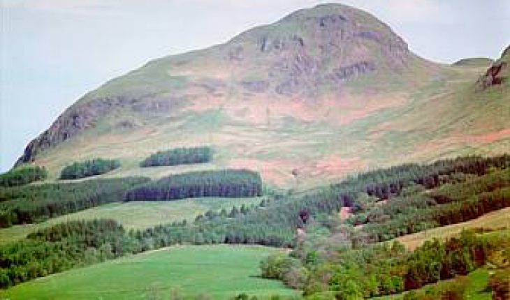
Dumgoyne, an extinct volcanic plug, is the distinct hill at the Western end of the Campsies, above Dumgoyne Distillery.
Despite being only 1,000 ft high and lower than the rest of the Campsie Hills, this hill offers superb views of the Campsies, Ben Lomond, Loch Lomond, and the Arrochar Alps.

Start this walk by driving or taking the bus to Strathblane on the A81 via Canniesburn. Park at the War Memorial (NS553803), and follow Campsie Dene road until you reach a gate. Climb over this and other gates along the track until you reach Cantywherry Cottage. Now leave the track on the right and head up the hill to the right, following the path up and left until you reach a small stream. From here you get superb views of the Campsies. Cross the stream and follow the path, which now levels out and runs along the base of Dumfoyne (the hill beside Dumgoyne) until you reach the base of Dumgoyne itself. Now climb onto the south-west shoulder of Dumgoyne and follow the steep but well-defined path up to the summit.

Map of walk to Dumgoyne.
Maps Required:
- OS Landranger 64: Glasgow & Surrounding Area
- OS Pathfinder NS 48/58: Killearn and Drymen
Dungoil
- Height: 900 ft
- Distance: 4 miles
- Difficulty: Moderate to hard.
- Total Time: Allow at about 90 minutes.
- Navigation: Once you leave the forestry tracks, the paths are indistinct and unclear.
- Starting Point: Just before Fintry on the B822 (NS640852).
- Public Transport: Bus to Fintry, then walk out of village to starting point.
A climb in the Campsie Hills through forestry land to the hill above Fintry. While Dungoil is only 1400 feet high, it offers superb views out over the Carron Valley to the reservoir and the Gargunnock Hills. Stout shoes or boots are adequate for this walk.
Drive to Lennoxtown and take the B822 towards Fintry. After the road has reached the highest point and is heading down towards Fintry, you will pass a hut on the right-hand side, and there will be a gate leading into forestry land on the left-hand side (NS640852). Park as near here as possible without causing an obstruction, go through the gate and head up the hill. If using public transport, take the bus to Fintry, and walk out of the village to the start of the walk. The path goes through the forest below and round Dungoil. As you climb up, you will come to a fork in the path. The right-hand path leads on to Dunbrach, while the left-hand path takes you up towards Dungoil. Take the left-hand path and follow this path a little way, then go up through a gap in the trees until you reach the summit of Dungoil. There is no clear path to follow, so just strike up through the firebreak in the trees and head for the highest point.
This walk can be extended by returning to the path and going back towards the fork in the path. Instead of returning to the start of the walk, you can continue on this path until just before it comes to a dead-end. There should be a wide gap in the trees on your left-hand side. Go up through this break until you reach a fence, climb over the fence and head for the highest point which is the summit of Dunbrach. Return by going back down to the path and following it back to the road.

Map of walk to Dungoil, Dunbrach and Holehead.
Maps Required:
- OS Landranger 64: Glasgow & Surrounding Area
- OS Pathfinder NS 68/78: Fintry and Carron Bridge


